Saturday, May 18, 2013

Sanibel Island

image

1305SanibelPaddle

(view in Google Earth)

I was in Fort Myers for the weekend, so brought my kayak with me to get in some paddling time around Sanibel.  I left home early Friday morning and arrived at the Sanibel Causeway around 12:00. 

From the causeway, I could see Fort Myers Beach in the distance, as well as the Sanibel lighthouse on the southern tip of the island.

IMG_1474

I paddled toward the nearest channel marker to have the last time in the channel as possible.  The bayside was flat calm with no wind or waves, at least until boats started coming through the channel.

IMG_1476

Rounded the point to paddle the Gulf side.

IMG_1491

IMG_1495

A pod of dolphins passed between me and the beach.

IMG_1499

A little while after the dolphins a huge loggerhead sea turtle surfaced about twenty feet from me – no picture because he got his breath and went back under before I could turn the camera on. 

I took a break on the beach on the way out and on the return.

IMG_1509

IMG_1512

The calm water of the bay was gone when I rounded the point, the wind had picked up and the tide was going out, so it was over a mile into the wind against the current. 

Once off the water, I discovered two things:

First, the front hatch of my boat has a leak, so I was shipping water when waves broke over the bow.  I drained quite a bit before loading up, but still had saltwater hitting my windshield in every decelerating, right-turn for two days.

Second, my sunscreen was less than effective. 

Ow.

Wednesday, July 18, 2012

Day 18–Cars, Ferries, Vans, and Kayaks

  Miles MPG Avg. Speed
Today 176 50.6 46
Trip 5279 47 48

Food
(today/budget)

Hotel
(today/budget)

Trip Savings

$25 / $104 $70 / $100 AAA - $26
PriceLine – $915
Real $$ – $280
Kayaking $204
Ferry $24


Note: Crossposted from my roadtrip blog.

Up at 6:00, then an hour drive to the ferry, and an hour ferry ride to Friday Harbor on San Juan Island.  Next time, I think I’ll just stay in Seattle and take the seaplane to the island.

IMG_0916

I like the island’s attitude … a taxi with racks.

IMG_0917

We met the van from the outfitter, Outdoor Odysseys, and took a twenty minute ride across the island to the put-in on the west coast.

IMG_0919

A popular put-in at the state park on that side of the island and some of the major outfitters have racks of boats there full time.

routemap

(view in Google Earth)

tripsummary

IMG_0925

We launched into some crystal clear (and cold) water, then rafted up with the guide and two other boats in the kelp bed.  Then we left the launch cove and started south down the coast. 

The flood-tide was running from south to north, so we had to hug the shore to stay out of the current.  This was hard for me to keep in mind, because a a rocky, lee shore with which I’m not familiar is a thing to give some distance.

IMG_0934

But staying near shore gave us the opportunity to check out some things exposed by the low tide that had just ended.

IMG_0939

IMG_0943

The far shore, eight miles away, is Canada and the Olympia mountain range, after crossing the 900-foot deep channel.

IMG_0959

After a couple hours, we arrived at the beach for lunch.  Outdoor Odysseys is one of the few operators that provide lunch – most others tell you to bring a sandwich. 

Fresh fruit, peanut butter and jelly, tomatoes, cucumbers and two kinds of hummus made up the lunch, all or mostly-all organic and local – pretty good, as well.

IMG_0961

At the lunch beach, a seal came by.  One of three we saw and the only one I was able to get a picture of.

IMG_0970

Also no picture of the ugly naked guy swimming and sunning himself.  He was frolicking in the water near the rocky headland and when he got out of the water, I said to myself, “That’s an odd looking bathing sui … nope, that’s his ass.”

Then he proceeded to flop down on the rocks and sun himself.

IMG_0978

Back on the water we proceeded south some more, still hugging the shore and Aryn got a great underwater shot of two seastars.

IMG_0991

For the return trip, we headed out from shore to pick up the still-flooding current.  The trip out there was pretty fun, with the current and back-eddies generating a lot of waves in unpredictable patterns.  I’d rate it a fast Class-II.

With the current, we hit 9 mph on the way back, according to the GPS. 

Then it was back in the van for the ride to Friday Harbor and the ferry.  We had time to eat again before the ferry left at 6:30. 

Sunday, July 1, 2012

2012 Roadtrip

Not paddle-related, at least until we get to Seattle, but my 2012 roadtrip with my daughter has begun: http://www.ontheroad2012.com/

Tuesday, May 22, 2012

Afternoon on the Wekiva

An afternoon paddle on the Wekiva today, but no pictures or GPS due to battery issues.  Those should be resolved before my next paddle, though.

I started at Wekiva Springs State Park and turned onto Rock Springs Run to paddle upstream until the water became to shallow to continue.  Then I returned to the Wekiva and paddled downstream past the marina for an hour or two.

Two small gators, a number of birds, and a bevy of drunken paddlers from the marina.  The highlight of the trip was a hawk carrying a squirrel (or some other small, furry dinner) that back-winged mid-river to reach a tree on the bank.

Part of this trip was to try out a couple pieces of new equipment.

First was a carry strap I got from topkayaker.net:

Kayak Carrier, premium shoulder strap

(stock photo – sadly neither the yak nor the brunette are mine)

I’ve used this the last couple trips, but those were short transfers.  It worked well for those, but the 100-yard sand path from the parking lot to the launch at the Park would be a good test, with soft sand much of the way that tends to bog down some kayak cart wheels and a significant elevation change between the parking lot and the launch area.

So what I found was that the weight, even on one shoulder, wasn’t a problem.  The 16’ length of the Tarpon is an issue, as it’s simply unwieldy to carry – controlling the ends, and such.  The biggest issue for a long portage with this device is that the bottom of the boat presses against my leg just below the knee – so each step rubs that spot back and forth along the bottom edge of the boat.

On the trip down to the water the kayak had been on top of the car for a couple hours, so had plenty of time to heat up the plastic and it was uncomfortable.  On the way back up again, the friction was noticeable – in fact, I believe there is a spot bare of hair on that leg now.  Next time I’ll have to bring some pants to change into for the portage – that should alleviate the rubbing.

Next were these:

image

I’ve been looking at the Vibram Fivefingers brand for a while and my kayaking sandals are just about at the end of their useful life, so I decided to try a pair.

These are the KSO model, along with the Flow, designed for watersports. 

So comparing them to the sandals I usually wear, I was favorably impressed.  Yes, the having-stuff-between-your-toes thing takes a bit of getting used to, but aside from my left pinky-toe, all adjusted quickly and even that awkwardness went away once they got wet the first time.

I was in and out of the boat several times and when the water got very skinny on Rock Springs Run I got out and walked for a couple hundred yards pulling the boat. 

The “feel” of these is very much like being barefoot, but still protected from rocks and logs.  I didn’t have a need to perch on a log while pulling the boat over, but I do think these would provide better grip and balance than sandals.

The bottom of Rock Springs Run is more sand than mud, but there are spots where the sand isn’t hard-packed and your feet sink.  These were easier to deal with in the KSOs than in sandals.  With sandals, once you’re foot sinks, pulling it out often creates a void between the sole of your foot and the sandal – that creates some suction and makes it more difficult to get out.  These both stay on and avoid that problem.

The fit around the ankle is tight enough that very little sand or dirt is able to get into the shoe.

Overall quite comfortable and effective.

Tuesday, May 15, 2012

Florida Keys

With a new car that gets much better mileage than my V8 Mountainer (even if a 16’ boat on 14’ Prius does look a bit silly), I can now worry more about where I want to paddle than how much it will cost me to get there and back.

IMG_1131

Since Orlando to Key Largo costs about $25 with this new rig, I decided that’s where I wanted to go this weekend.  Unfortunately, the weather didn’t cooperate, with 15+MPH winds Saturday and Sunday, I was only able to paddle on Friday and Monday.

After driving down and checking in at my hotel in the morning, I stopped at Florida Bay Outfitters for a new hat and rash-guard shirt.  Since I was there and they’d started selling their rental fleet for the off-season, I also bought a boat … which will bring to five the count of boats in my garage when I pick it up in July.

Now, five boats may seem excessive to some people, but each has its own specific purpose and use.  So to justify myself explain each boat’s purpose:

  • My primary boat is the 16’ Tarpon pictured above.  It’s stable, tracks well, and it’s generally comfortable, except for the still-missing ass-pad seat cushion that I still haven’t replaced.
  • Then I have a Pamlico tandem, which I’ll likely be selling soon, as I have a new rule of never going with someone who won’t paddle their own damn boat.
  • Next is a 9.5’ Swifty that’s mostly used by my daughter, but it’s a light, handy, cockpit boat that’s nice to throw on top of the car for a quick paddle in the morning or afternoon.
  • Lastly is an Ocean Kayak surf boat which I got to have a surf boat for the boy-child to use.

The new boat will be a 14’ Tarpon 140:

image

This will give me a boat similar to my primary, but a bit shorter (easier to control) for when I want to take someone who doesn’t have their own boat.  In addition, it has a rear well instead of a hatch, so it’ll comfortably hold dive gear.

See?  I absolutely need five boats …

Friday Afternoon – Lignumvitae Key

110512-LignumvitaeKey

(view in Google Earth)

2.5 hours – 5.5 miles

My plan for the weekend was to paddle the three Keys accessible from the causeway between Upper and Lower Matecumbe Keys, Lignumvitae, Shell, and Indian Keys, with a possible diversion to snorkel at the wreck of the San Pedro (about a mile south of Indian Key):

110512-PaddlePlan

I took a quick paddle around Lignumvitae – it was a beautiful day, with little wind and crystal clear water.  On the way back across the flats, I passed a 3’-4’ nurse shark cruising along the bottom. 

Saturday & Sunday

The weather forecast for the weekend called for 15+mph winds.  When I arrived at the put-in Saturday morning, it was clear that the wind would be an issue on either the Gulf or Bay sides, so I took the opportunity to spend the day in Key West. 

That turned out to be a good decision, as the beach rental at Smather’s Beach in Key West claimed 20-30mph winds and Bahia Honda wasn’t even renting kayaks because of the wind.

More of the same on Sunday, so I drove to Everglades National Park and spent the day there.

Monday Morning – Blackwater Sound

110512-BlackwaterSound

(view in Google Earth)

3.75 hours – 10.3 miles

The forecast for Monday called for 10mph winds dropping to 5mph in the afternoon.  I put-in at Florida Bay Outfitters and paddled across Blackwater Sound to Dunedin Creek, taking a bit of a detour into the mangrove creeks to explore.

Coming out of Dunedin, I made for the western edge of Little Buttonwood Sound, which put the paddle at five miles.  My plans were to head west from there toward Porjoe Key and then on to North and South Nest Keys.

110512-BlackwaterSoundToNestKey

At this point, though, the winds did not seem to have died down and were out of the East and Southeast, so continuing the trip another five miles to Nest Keys would mean a ten mile return mostly into the wind – with the first half of it giving the wind a five mile fetch across open water. 

If I’d had camping gear with me, I’d have taken the chance, knowing I could just stay overnight and paddle back the next day.  In fact, I think I’ll do that next time.

Saturday, December 17, 2011

Saint Joseph Sound Spoil Islands

December in Florida.  On the water at 11:30, clear blue skies and 72-degrees.

PC170012

This was a trip to visit the spoil islands in Saint Joseph Sound to pick one for camping in a few weeks.  Spoil islands are the result of dredging channels – the material dredged from the bottom of the channel is loaded on a barge and the barge is periodically dumped to the side of the channel.

This results in evenly spaced islands (or bars if there wasn’t enough material) along the line of the channel.  In this case there are six islands about a half mile apart running north of the Dunedin-Honeymoon Island causeway.  The channel continues to the north, but the islands stop – the northern dump sites didn’t rise to the level of islands.

route

(open in Google Earth)
(7 miles – 3:30)

There’s a lot of rock and oyster shell around the causeway and islands, much of it exposed at low tide, which is when I arrived to put in.  The oyster shell will tear up a boat faster even than rock, so don’t drag your boat over it.  Also watch your step, as it’ll slice your feet up just as easily.

PC170013

I set course for the first island in the chain and started off.  Getting there from where I put in on the causeway meant crossing the boat channel.  I always laugh at kayakers who start talking about marine law and right-of-way regarding powered boats. In my book, right-of-way goes to who won’t wind up as flotsam and chum after the collision, so I always make sure the channels are clear for a long ways before trying to cross.

This is not clear enough:

PC170014

The reason we wait until it’s completely clear, of course, is because no matter how well the day’s going, no matter how swift your stroke is … dead center of the channel will be the spot your cooler decides to slide off the back deck of the boat and become a sea anchor.  Did this happen today? Of course it did.  This is why I want a new boat.

On some of the islands, local conservation groups are busily at work replacing non-native vegetation.  While I can agree with this in principal, I still think the Australian pines just look better than native growth.

PC170015

The first and second islands north of the causeway have rock fire pits and cleared areas suitable for camping.  The second is larger and someone has brought in a picnic table.

PC170017

PC170026

Both were nicely free of trash, with only a few cans or bottles around.  Most of these had already been placed in the fire pits.

On the first island, though, there’s clearly a “bathroom” area that some people aren’t following “leave no trace” in.

PC170023

If you can’t handle packing it out, then stay somewhere there’s a toilet. 

The third island north of the causeway is an Audubon sanctuary, so landing is not permitted.  The fourth was inaccessible during my trip due to the tide – exposed rock and oyster shell made landing a bad idea.

PC170057

PC170058

Island five had a little surprise in store for me.  The low tide exposed a spit of sand and an odd looking rock that turned out to be this little guy:

PC170042

Not every day that you see one of these on the beach.

The last island in the chain is small and rocky, with only a few scrub trees for cover.

PC170054

Even so, if the weather forecast is good, it will probably be my choice for camping, because it’s isolated and well-positioned as a base.  From here, it’s only two miles to either Honeymoon (red) or the bars north of Honeymoon (green), and from them it’s only another two miles to Anclote (blue).

options

Monday, May 31, 2010

Things I Want to Do

This is the Florida-list of paddles I want to do and doesn’t include U.S. or world trips.

7-Mile Bridge

I’ve always found it a bit strange that for all the time I’ve spent in the Keys I’ve never paddled 7-Mile Bridge.

7MileBridge(view in Google Earth)

I’ve paddled a lot of the areas around it, but for some reason never just did the paddle from one bridgehead to another.  There’s nothing particularly special about the route, it’s something you do just to say you’ve done – and I haven’t yet.

Suwannee River

I’ve paddled portions of the Suwannee, including Florida’s rapids, but paddleflorida.org has an annual trip that sounds like an absolute blast.


View Suwannee Music Camp to Manatee Spr in a larger map

Eight days and 123-miles of paddling and camping.  Breakfast and dinner catered with sandwiches at the lunch stops.  And a shuttle for the beginning or ending of the trip.

In my younger, more foolish and less achy days, I might have scorned this sort of trip, scoffing that rehydrated eggs were the only breakfast a real camper needs, but as I’m now older, and ostensibly wiser, catering and the occasional shower doesn’t sound so bad.

This is a trip I may take this year, as it’s upcoming in October … of course, I’ve said that the last three years and not made it. :(

And the popularity of their trips seems to be growing, with five other paddles on various waterways planned for the next year. 

The Florida Circumnavigational Trail

I’ve written about this before.  Obviously completing this journey is more than one trip, but if I want to do it, I need to start soon, I think.

Because of the distances involved, though, I need to find a crazy person partner willing to undertake it with me – arranging this number of shuttles over these distances would be problematic.  Two cars and a paddling partner would be preferable. 

Hopefully a partner able to take a long weekend every couple of months and paddle a segment – four years, maybe, to finish the whole thing at that pace?

Saturday, May 22, 2010

Happy Birthday at Haulover

For my birthday morning, I took my daughter and a friend of hers to Haulover Canal.


View Haulover Canal in a larger map

After a long drive to pick up her Little Boy Friend*, we hit Subway for breakfast and to pick up lunch.  At Subway, they gave me a Sharpie to put our initials on the lunch sandwiches, which, of course gave me the opportunity to write LBF on her friend’s – he seemed to have a sense of humor about it, she erupted in a chorus of “I can’t believe you did that!”

Kayaking and annoying the girl-child … life is good.

We were on the water by 10:00 and headed up the canal.

route(view in Google Earth)

GPS tracking powered by InstaMapper.com

I put the kids in a tandem Pamlico while I paddled my Tarpon.
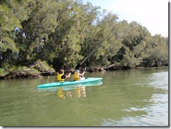
P5220004Shortly into the paddle, we spotted the first dolphin of the day.
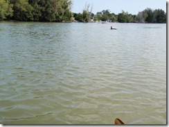
P5220005And shortly after that, the manatees.

P5220008P5220009 P5220014 We left the manatees and the kids did a little exploring of Haulover’s unique shoreline.
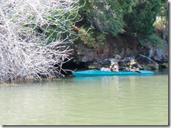
P5220018 Shortly after this picture, they drifted closer to the branches and I heard the girl-child express her concern that a snake might drop on her. (You may express your ridicule in the blog comments and I’ll make sure she gets them.)

Under the bridge and past the manatee observation deck, there was a pair … sporting.

P5220020Some conversation in the other boat about what they were doing prompted the girl-child to ask me what I thought:

“Well, sweetheart, when a mommy manatee and a daddy manatee love each other very much …”

“So you think they’re having sex too.”

A short way further along I spotted an alligator near the bank, but he sank out of sight before I could get a picture.

We exited the canal to the North – here are the mangroves where I stopped us to tell the kids the Mangrove Story.
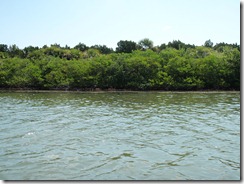
P5220026What’s the Mangrove Story?  Well, I believe that we should take advantage of opportunities to educate children:

“Mangroves are very important to the coastal eco-system, because their roots provide a protected environment that acts as a nursery for many different species of fish, crabs and shrimp.

“Interestingly, if you take a 10’x10’ piece of nylon netting and some lead weights and use them to submerge a body amongst the roots … in two weeks it’ll be nothing but bones from all those little baby fishes and crabs.

“You should remember that as you spend time hanging out with my little girl.”**

The kid seemed to be a good sport about this story, too, because, of course and on advice of counsel, the Mangrove Story is just friendly kidding.

Just before heading out into the lagoon, we came across a barnacle-covered piece of driftwood.

P5220027 P5220028 The wind was out of the NE today, so we headed in that direction, crossing the lagoon before stopping to drift back as we ate lunch.
P5220032 After lunch, on the way back, the girl-child will claim I fell in the water.  I deny this charge.  Here’s what happened:

Because I had forgotten to bring towels, I was unable to improvise a ass-pad seat cushion as I have recently.  After the paddle across the lagoon, the lack was being felt, so I stood up to stretch my legs.

The Tarpon is a very stable boat, so standing up is not foolish.  I’ve stood in it to fish before with no problems on calm water, and it was quite calm today.

From my standing position I was enjoying the view of the clear, shallow water when I spotted what I thought was a small turtle.  A second look showed that it was a large crab and since the water was so shallow and clear, I wanted to get a good picture of it, so I quickly sat down.

Standing in the Tarpon is perfectly okay … sitting quickly, not so much.

So, yes, part of me left the boat, but since it was only one leg and became wet only to the knee, while the other leg and the rest of me stayed in the boat, I do not believe this qualifies as falling out.

I subscribe to the philosophy that any exit in which my hair remains dry qualifies as a controlled-exit from the watercraft.

I did not get a picture of the crab.

After that incident, though, I did get a picture of a pelican in flight.
P5220039

We also saw the second dolphin of the day off in the distance.

On the way back, the kids took a disturbingly close look at the mangroves.

P5220040 Of course I actually use a far more remote patch of mangroves there was nothing out of the ordinary for them to see.

Back through the canal, now much more crowded with fishermen, and saw the third dolphin of the day off-shore as we loaded the car – or, more probably, saw the first one of the day again, but still good to see.


* I call all of the girl-child’s female friends her Little Friend and the males are referred to as her Little Boy Friend.  I do this for two reasons: first, it saves me the trouble of trying to remember names; and, B, it annoys her to no-end.  Yes, I’m lazy and cruel.

** The Mangrove Story is intended solely as an amusing anecdote and does not constitute an admission of guilt or any knowledge whatsoever about missing teenage boys who’ve hung out with my daughter.